
Last time, I showed you the sight we would’ve been able to see from the hill above Lewiston, Idaho, if it hadn’t been dark. In gathering maps and info for this post, I discovered something else, that had I known about it, would’ve guaranteed that we’d gotten on the road much earlier so that we could’ve seen it.
What could that be, you ask? I’m gonna show you!
At the top of Lewiston Hill, which is where that view shot was taken from, is this sign:
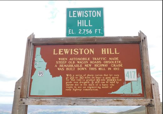
But you don’t realize what an engineering marvel the road was till you see photos lidis, which is the top of the road:
And this, which is the lower part which goes into Lewiston:

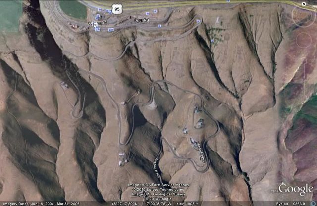
To really get an idea of the road, I zoomed in to get this view:

Garanz next time Nolemana, Musubi and I come this way again, we’re gonna take that road!! Garanz. I woulda gotten up two hours earlier in order to have been able to do it this time, but I neva know was dea!
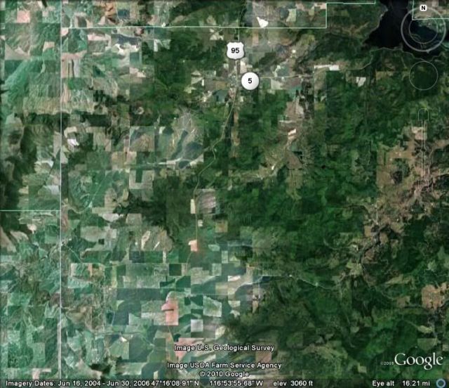
Instead, this is the way we went as compared to the fabulous old spiral road:

This next part of the trip we took in total darkness; I was very disappointed that we didn’t get to see the rest of the Palouse country as we headed north on Highway 95. No photos. It was too dark. Next time it’s gonna be different.
All I can do is show you folks on GoogleEarth where we were. I am really sorry we couldn’t see any of this.
K’den. We go North from Lewiston through Genesee.

This farmland would’ve been gorgeous to see. We go through the college town of Moscow.

Still heading North, we go close by Potlatch, Idaho.

We continue North. By this time we’re getting pretty darn tired.

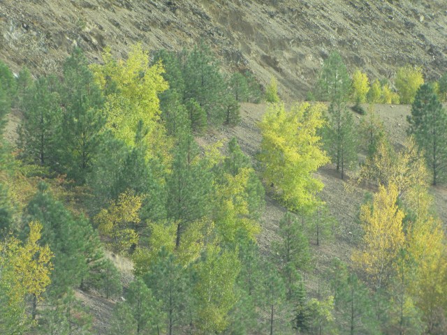
I bet this countryside is lovely in the spring and summer!

Now we’re getting hungry! We’ve been on the road since noon and I think it was about 8 p.m. by now.
We’re coming into our destination for tonight. Anybody wanna guess where we are?

Yep! Coeur D’Alene, Idaho.
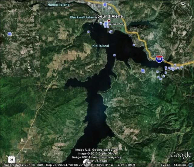
This is a map of where we were on this last leg of today’s holoholo ka‘a.

Ho da tired! I’d been in Coeur D’Alene in June and we’d eaten at Perkins Family Restaurants; they stay open late, and since it was after 9 p.m., that’s where we headed.
From there, we went to the Shilo Inn where my friends and I had stayed in June. We pretty much showered and fell into bed. Ho da tired!! We had a pet friendly room for Kukui and us.
The next morning after eating breakfast, we headed out again. 9:10 in the morning.
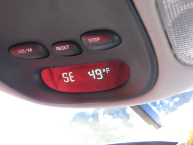
Too early for this:

Hmm…. which way are we gonna go? Anybody like guess?
Aww c’mon. Try guess!! I promise I’ll tell you right away.
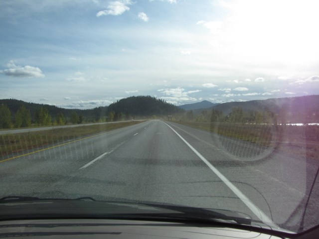
Out onto the open highway we go!
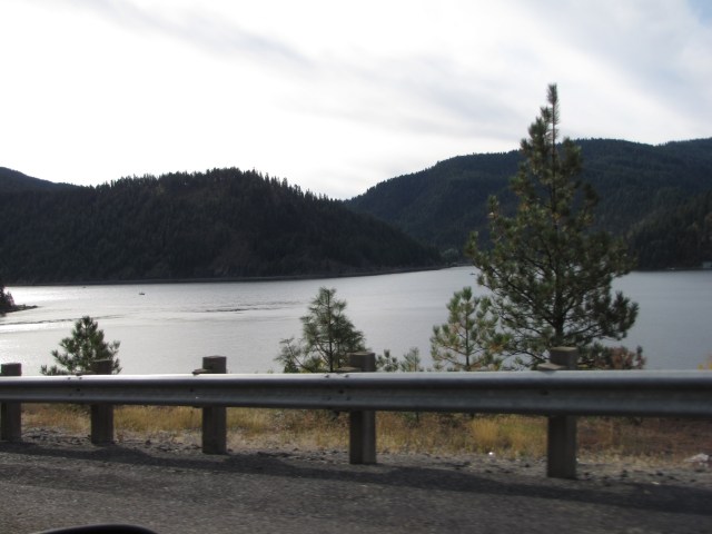
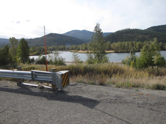
Here are several shots of Coeur D’Alene Lake.

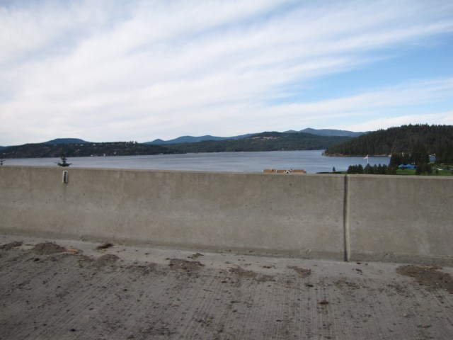

The lake is just beautiful!
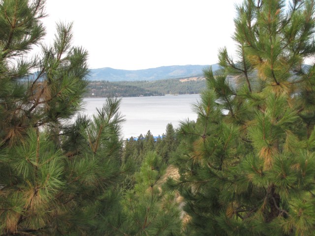
We took lots of photos of it. Can oni tell, yeah? I imagine there are lots of boats out there in the summertime.
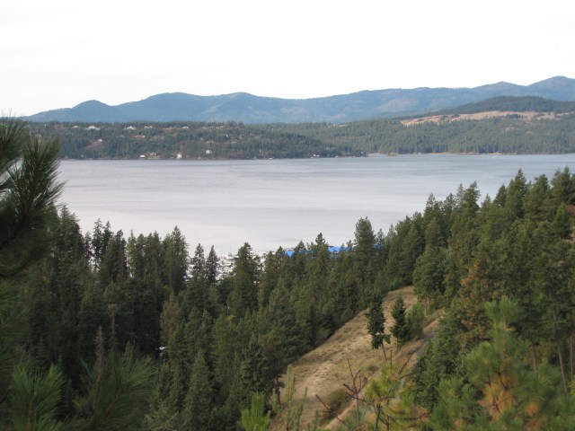
This was our last view of the lake.
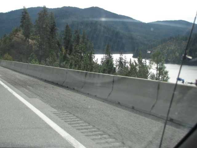
Out on the highway, trees were just starting to turn.
Try wait! We’re not past the lake after all! LOL.
Okay, for realz, this was the last shot.
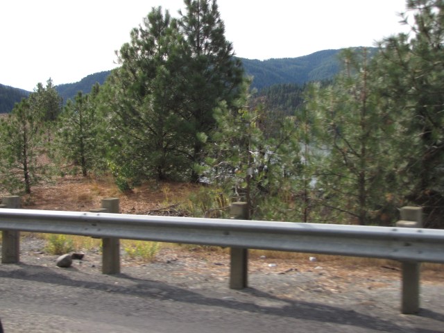
We’re now heading into the Idaho Panhandle National Forest.


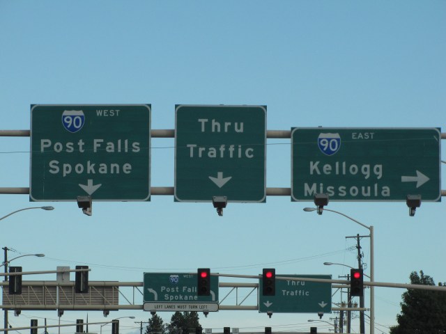
Here we are near the exit for 4th of July Pass in the Panhandle National Forest. Now I don’t even have to tell you which way we’re going, right?
Yes, we’re heading East on Interstate 90.

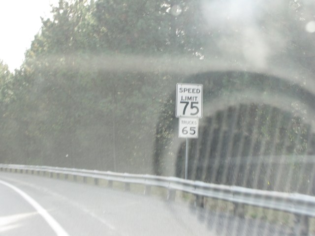
Try check out the speed limit!

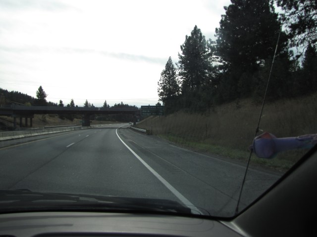
This is just past Tamarack Ridge Road.

Still heading East. It’s now 9:40 a.m.

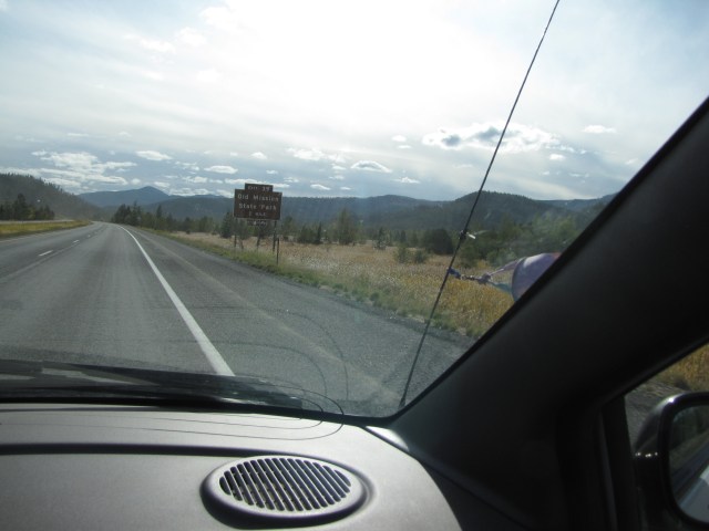
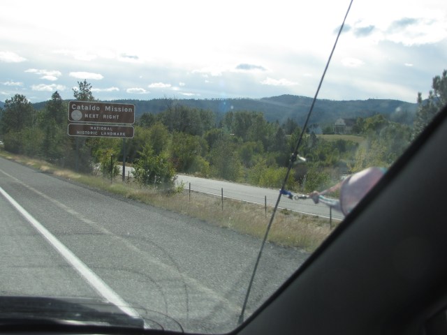
Exit for Old Mission State Park, where the oldest standing building in Idaho is located. I wish we’d had time to stop.
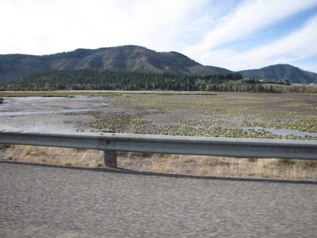
Still heading East. We were thoroughly enjoying this drive, as neither one of us had ever been here before. We loved the wide open space!
Water draws my eyes like a magnet! I guess I already said that ukubillion times.
This is the Cataldo Mission exit. The building (which we couldn’t see) is the oldest standing building I was telling you folks about.
It’s now 9:41… hard to believe we’ve only been on the road for about thirty minutes and seen so much beautiful country. And now, try look! Ho da fast!! These were the first times seeing this kind of legal speed. This is about two minutes past the Cataldo Mission exit.
Whew! This is how far we’ve come so far. And it’s not even lunchtime yet!

What a trip!! I absolutely adore exploring new places, even if we’re travelling at 75… well, okay, 80, miles an hour. So far this is a fabulous trip! Thanks again for tagging along; I love having your company!

Ho da nice! I, like you, am drawn to water. And dat switchback road is not only ingenious, it’s crazy! I would get so carsick going down dat road. And ho da fast da speed limit – you guys not even in Montana yet!
I know, and we could end up going North still.
Eh, did erryone wiz past you guys? Cuz down hea, even if da sign says 75, unless get cops, erryone goes at least 80/85. Lead foot heaven! 😉
Talk about zig zag that other road. I’d love to take that road too, of course in the day time! You know how funny, because I was thinking how wonderful it would be if your trip was in the spring! But still, I’m loving every mile 😀
Those pictures are much prettier than my memories of driving across Idaho heading towards my sister in Seattle when I was in college; thank you!
Definitely going to have to check out Lewiston Hill on our drive out. Awesome!