
I better hurry up and finish this journey; Suzette and I text a lot, and if I don’t finish, I’ll never be able to scroll up far enough to find our conversations about the trip!
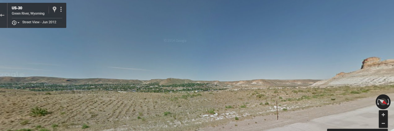
Last time, we were almost to Green River, Wyoming. Just past that photo, we came to this big tunnel up ahead.

While on GoogleMaps, I checked out what the side view looked like: no wonder the town’s named Green River!
Now keep in mind, that this whole time Suzette and I were texting, I was constantly looking at GoogleMaps as well as the Wyoming webcam maps, hoping to find a webcam that would catch them in its eye just as I was there. I was a busy girl. Good thing I can multi-task! Oh yeah. And coughing like crazy. But virtual road trip, yeah, so Suzette and Owen couldn’t catch my bug.
After going through the tunnel, we were in open country again.

Suzette knows how much of a foamer I am. Yes, that is a real word. I think I’ve told you about it before. It’s a person who foams at the mouth seeing trains go by. Engineers use it all the time; I don’t think it’s a particularly endearing name to them. According to the Urban Dictionary, an engineer said to a conductor:
“Man, we got some foamers ahead taking pictures…they need to just get a life and find something to do besides hang around the tracks all day.”
We can’t help it! We love trains; what can I say? And I love this photo she took…it’s a beauty! Owen thought it’d make a good shot, and I like that he was participating in this whole road trip like this.

I wonder if that train was once in front of the Missoula webcam! I take so many screenshots from there, that it coulda been.
Suzette wondered if she were bombarding me with too many photos. “Never!” I replied. Seeing all the photos and texting with her kept my mind off how miserable I was feeling.
(I did wonder at one point if I had unlimited texting, but decided that even if I didn’t, it’d be worth it.)
This is what my computer screen looked like. See all those choices on the far left? Those are where the webcams are, and I kept clicking on each of them, trying to see if I’d get really lucky and see that big yellow truck in my screen. I know, it’s major blurry and I can’t seem to fix it. Everything below the blue on the far left are all the webcams I was clicking on, trying to find them. I’d click each one as Suzette told me where they were, trying to figure out where would be the easiest place to see them. Short stretches of road would be the hardest because the view would only catch a few cars and trucks. I sure got to see a lot of Wyoming that way! Suzette and Owen kept on rolling east, and I kept trying to catch them on camera, with no luck at all. At least texting was fun!

In the meantime, Suzette also sent me a video. I’m not sure where they were, though; somewhere east of Green River.
In these two photos, Suzette tried to get a good photo of two trains as they were heading toward each other. It was “too far and I’m not fast enough!”, she said. Do you think I’ll turn her into a foamer, too?


Texting:
Me: “Thank you for letting me ride shotgun.”
Suzette: “Hehe…so fun to have you along!”
Me: “Can’t you just hear me hollering “Train!” whenever you see one?”
Suzette: “I can! Toot toot!”
Yes, there’s hope for her for sure.
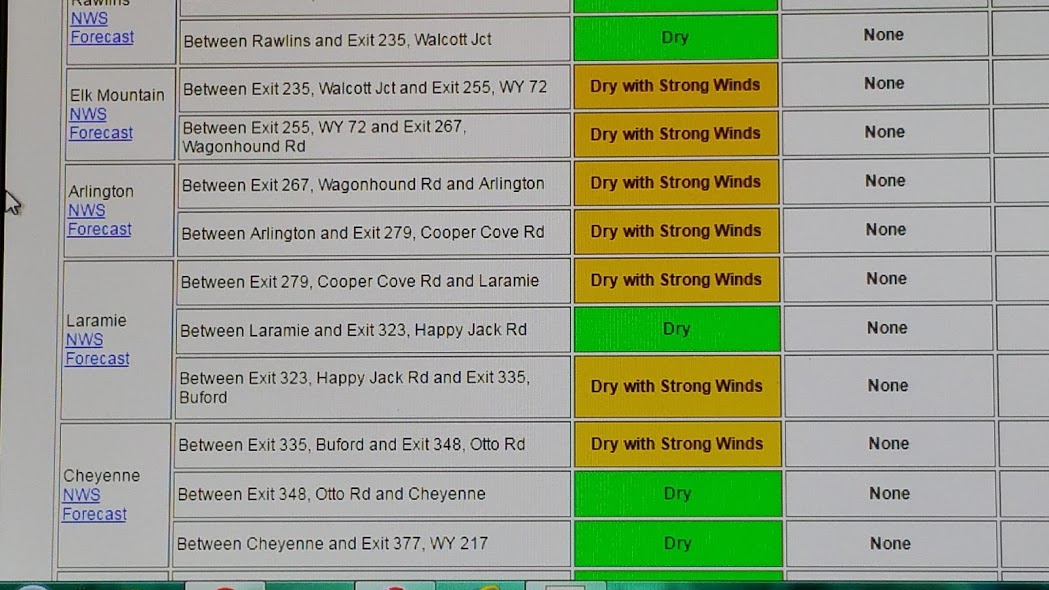
Now they’re in Red Desert: elevation 7000′ and they just crossed the Continental Divide…46 miles to Rawlins and 188 miles to Cheyenne.
I Googled road conditions up ahead, and sent this screenshot to Suzette. The brown fields say “Dry with Strong Winds” and the green ones, “Dry”. And at the far left, the different towns.
Suzette sent another photo:
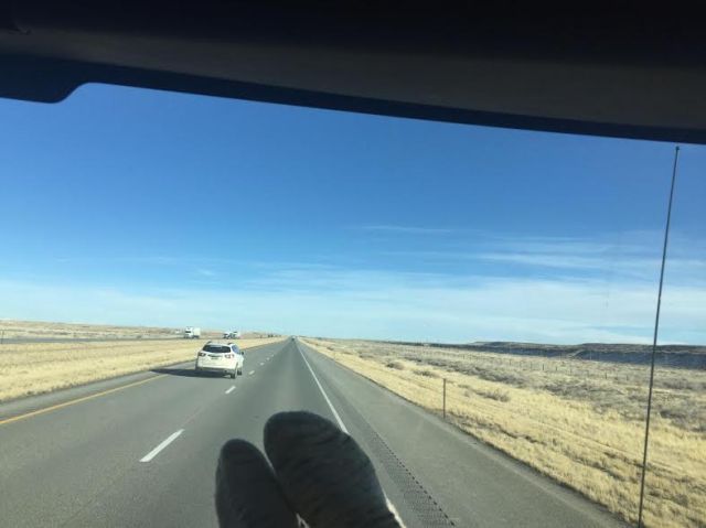
You may ask, “What’s that shadow at the bottom of the photo? Is there something weird on the road?” Nope. It’s Suzette’s feeties, clad in hand-knit socks, up on the dashboard.
I told her that there was a Flying J up ahead, just before Rawlins. Because I was still checking maps and webcams, of course. With no luck, I might add. But I thought, I wonder if I could catch them at the Flying J. Not that I was obsessed or anything.
Hadsell Road: Exit 206

More blue skies and open country.

I told Suzette that Walcott Junction was up ahead. She told me that they would cross the Continental Divide again before Rawlins. I remembered how, when Nolemana and I were in Yellowstone, how we’d cross the Continental Divide over and over again and we wound our way through the park.
Just for kicks, I went to Google Earth to see what it was like near Rawlins. It sure did look rather desolate.

K’den, that’s the end of this part of the road trip. We were having a good time texting, but I still was trying to find them on a webcam. Wyoming is big and I thought, “Surely I can make this work”, but apparently I was wrong.
I’ll tell you this much, though. Wyoming WYDOT webcams are fabulous! They have cameras facing east, facing west, and what the road surface looks like as well. And each photo will have a caption like “View facing east”, “View Facing West”, so it’s extremely easy to know exactly what you’re looking at. I didn’t see the big yellow truck, but was extremely impressed at how thorough the webcam websites were.

Interesting that there doesn’t seem to be much snow on the ground in these photos. Can see some on the higher elevations, of course, but not so much on the ground.
Thanks for taking us along!
I mentioned the same thing to Suzette, and she told me that Wyoming was having a very cold but dry winter. I thought there’d be tons more snow, especially at this elevation. Thanks for riding along!
I’m so enjoying re-living this fun trip with you! What a hoot!
I love reliving it too!! We make great company for each other, don’t we? Love you!