
Ho, it’s hard not having any work right now, but at least it gives me time to do bloggie updates. We do need the work however; this blog doesn’t pay the bills! But I’ll keep doing these updates quickly as long as I can.
I hope you’re not on dial-up. This post is photo-intensive!
Here’s a terrain map of where we are right now. Well, not right this minute. Cuz I’m here at home right now in case you didn’t know. But on our Mystery Road Trip (which really isn’t a mystery anymore as you know), this is where we were. This is our route going through the Blue Mountains. See North Powder there? I posted that sign on our last installment. It’s easy to see why the pioneers chose this route through the mountains!

But we still hadn’t begun to really gain any elevation yet, and the road and the awesome sky stretched out ahead of us. We are still in cattle country here, but all the pīpī were somewhere else than here.

Another oxymoron, at least for the time being. I bet as I’m typing, there’s plenny snow on the ground at this very spot!

Kukui loves to rest her head on stuff. Boxes, bags, and in this case, the armrest. She travels like this for long periods of time.

It’s a little blurry… hard for Nolemana to reach around and take the photo, but you can see how she was resting her head. So kewt, yeah?

Now we’re beginning to climb up into the foothills. The mountains definitely do not look blue anymore. I don’t know what that phenomenon is, that things in the distance take on color but when you get to them they’re not that color at all.

“Barn!!!!!” (Heh heh.)

Awesome job, Nolemana!! You’ve got a fast draw there!

I wish TryLook had had an elevation setting on her so we could’ve known how high up we were at this point. Baker City’s elevation is 3451′, and we’re obviously higher than that. In a snow zone, too. This area is called Ladd Canyon.

And look! Trees!!! Lots of them! I looked at the landscape and the highway ahead of us, and tried hard to imagine coming through here on a primitive road in a covered wagon. Definitely a daunting task. The road would have barely been a road, really, and filled with logs and rocks to boot. Remember the sign in the last chapter? Nobody wanted to build a road!
The road to the right is one coming from a rest area; we didn’t stop there, though.

Then the road leveled out again. I bet when the pioneers got here they breathed a sigh of relief at having some flat land to travel through for awhile.

But then they would have put the pedal to the metal…oh, try wait. No pedal. No metal. Just taking a deep breath, encouraging the oxen, and heading up.

Now we know we’re getting closer to home! It’s the first log truck we’ve seen since we left home!
It’s a lot less scary having a log truck in front of you than having one coming directly at you, let me tell you! Seeing those monsters coming right at you around a sharp curve at sixty miles an hour or so can be a bit unsettling.

“River!!!” Almost too late, but he made a valiant effort.

“Train!!!” Poor Nolemana!

He did good though.

“River!!” I tell you, he’s gonna get a whiplash if I don’t shuddup.
Remember how last time I told you how I’m a person who’s all about the journey, and how serendipitous events fill my world with joy and laughter? Well, here is another one of them. There we were, just driving along, when I hollered, yet again, “TRAIN!!!!!” This time I was really excited because I could clearly see the photo op we had. And bless Nolemana’s heart, he quick captured this amazing shot of the train coming around the curve! Isn’t it just awesome?? Not a speck of blurriness in the photo even though I was practically jumping up and down in my seat! To me, this is a perfect shot.

And he even got another one!!! Two awesome shots, right in a row!

By this time I was smiling and happy, and told Nolemana, “See? I don’t need expensive kine presents…this one fills me to overflowing!” (In other words, I am a cheap date.)
Now we’re at Milepost 250. The numbers are going down quickly. We are now in the middle of the Wallowa-Whitman National Forest. Whitman as in the couple who started the mission that we Wai-lat-pu Mission. I wrote about it in Part Two of this lengthy road trip. Yeah. ‘Way back there.

The forest is huge!

There was obviously a fire here at some point; the trees are just now growing back. Or maybe it was clear cut. (And don’t even get me started on clear-cutting!)

Exit 243. We took this photo for a friend of our named Emily. This was another road I would have enjoyed taking.

And look! The summit of the Blue Mountains! Ho, it came up so fast we barely got a photo of it. If we’d missed it, I would’ve backed up along the road so we could get it. I’m known for doing things lidat.

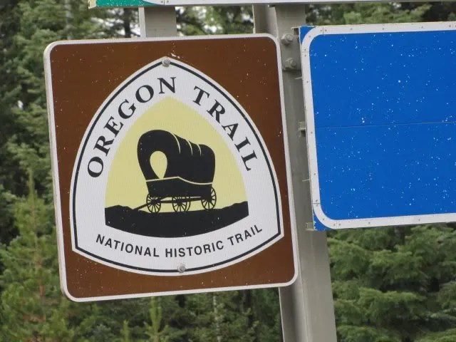
See the covered wagon sign? Everytime there’s one of them, it means that we’re still on the old Oregon Trail. Next time we will try to take time to take a brief detour and see what’s there. This time, though, we just had too far to go before getting home. Meacham used to be a stage stop, too.

Kewl da sign, yeah?
Try look. We’re going downhill. Well, that makes sense, right, since we just passed the summit? Like the bear went over the mountain..♫ ♪ (Mokihana, you are so weird!)

I have absolutely no idea why we took this photo. Any guesses?

I wish we could have explored this area more, too.
The people of the Cayuse, Umatilla and Walla Walla Tribes once had a homeland of 6.4 million acres in what is now northeastern Oregon and southeastern Washington. In 1855, the Tribes and the United States Government negotiated a Treaty in which the Tribes “ceded,” or surrendered possession of, much of the 6.4 million acres in exchange for a Reservation homeland of 500,000 acres.

I was born to wander. I was born to take side roads and explore to my heart’s content. Yet here’s another info center that we had to pass up.

Here’s a topographical map of Deadman Pass. If you follow the road north along the pass, eventually you’ll end up by the Umatilla River.

The pass is on the other side of this hill.

And, for your viewing pleasure, a lovely guard rail photo!

See? Doesn’t the name just call to you, begging you to take the exit? It does me! I felt the same way about the signs in Montana. Like Bearmouth. Begging me, I tell ya. Next time.

The forest was a welcome sight.

And forest on the other side, too. We’re almost at the top of a very steep downgrade.

We had to take a photo of these gimegahugeicgantic tires!

For a couple of miles, we’d been seeing warning signs about the long, steep downgrade ahead of us. Like “First Warning” and “Second Warning”, all the way up to “Third Warning”. Then this one. So pay tenshun!!

Here’s another topographical map of our journey through the Blues.

And another one, showing our whole road trip from Baker City to Deadman Pass.

What a ride! GoogleMaps says it takes about an hour and a half to go about 77 miles. I wonder what the pioneers of 1843 would think of being able to make the trip in that short amount of time. It would be totally outside their frame of reference, wouldn’t it?
We zoomed along at about 65 miles an hour. At twelve miles in a day, it would have taken them almost seven days to do the same! (Yes, Mokihana can do math. Not trig, however.)
Next time, I will treat you to some of the most beautiful views in the state of Oregon. I can’t wait!

Great photos. Nolemana, you da man!
You made me think of this song when you said you were born to wander:
“The Wayward Wind,” Gogi Grant
I like the way the photos started out FLAT and then the hills appeared. I love seeing Kukui too. That is how Keiki, my doggie, travels too. And a lot of times, even though she is a little too big for my lap, her favorite way of traveling is on my lap. Of course, she being my baby, I let her have my lap.
Great photos of the train’s engine! That is some ACE photo shoot!