
I gotta tell u folks, driving along da Clearwater River in Idaho is a whole trip in itself. There was so much beauty, so much to see, and our senses were on overload. Before we left I’d plotted out our route, only knowing that I wanted to go a different way than we’d gone before. I kinda picked the Orofino route because it looked fun and interesting, but I never dreamed how beautiful it was gonna be.
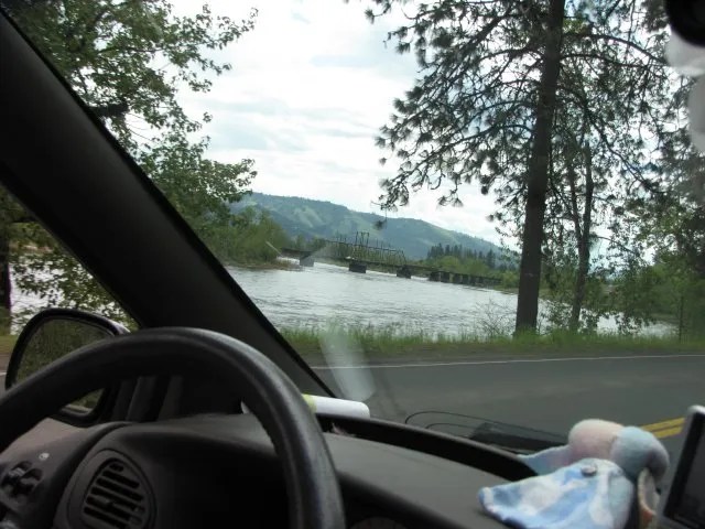
As we continued alongside the Clearwater River, we saw a train trestle. Gotta have a photo of dat, right? Cuz wat if get train??!!
Musubi was content just to stay next to Try Look. He loved her.
Closer view of the trestle. I really have no idea if it’s been in use or not. This trestle is just makai of the town of Kamiah, Idaho.

This was one of the first street signs we saw as we came into town. LOL!

And here we are! Is it Kameeya? Ka mye ah? Po tay to? Po ta ta?

If u like read more about da town (and u really should cuz it’s super-interesting), go hea.
For instance, you can learn that:
Older than the recorded history of the West, Kamiah was the winter home of the Nez Perce Indians. It was here they came to fish for steelhead, a staple in their diet, and to manufacture “Kamia” ropes, hence the name Kamiah, meaning the place of “many rope litters”.
Lewis and Clark camped for several weeks during the early spring of 1806 in the Kamiah Valley waiting for the snow to melt before they could continue their journey east. The valley is rich in the heritage and legends of the Nez Perce and it was here, among the ancestors of the present day Nez Perce, that the Appaloosa horse was first bred, primarily for use as a war animal.
This is history, you guys!!
Alongside the road, someone had planted some really pretty flowers.

Actually, I think it was at a nursery or greenhouse kine place, because I see the tabs in all the plants in the background. Maybe I shoulda looked for a lilac here!

Oh. It was a nursery and they were having a sale! Sheesh. I missed it.

We drove further into town. This was an interesting place.

This is on the highway coming into town.

Ultimately we’d be heading towards Missoula, but now we wanted to explore the town. It was about 1 p.m. and we were getting hungry.

We turned right onto Main Street.

We drove around, getting our bearings. We loved seeing the signs right in the middle of the road! But this first one directed us to where we thought we might find something to eat: Hearthstone Bakery and Tea House.

This is the Kamiah Fire Station! Doncha just love it?

And the library and City Hall. Now see, this is what I love about small towns like this. Really unique buildings with no pretentiousness about them. Just good, honest, buildings, with their own character. I was lovin’ it!

And try look da Eye Clinic building!!

So we parked in front of the Hearthstone Bakery, and when we walked in, we immediately notice the wonderful ceiling.

Here we are right at the entrance, looking toward the back.

Booths on the right hand side of the place. We were just going to take sammiches with us or we would have sat there.

Here’s another photo of the ceiling.

And this beautiful stained glass picture.

And since it was also a tea house, there were tea cups and tea pots. Very Victorian.

This is the bread-slicing machine. It was neat watching it work.

So we got our sammiches and headed out again.
We saw this cool weather vane; I forget what building it was on.

And this wonderful one was ontop da Fire Station. Wea else?!

We drove through town once more to make sure we’d seen everything we could. It would have been fun just to explore the town for a couple of hours, but we still had a lo-o-o-ong way to go.

Try wait!! Wat’s dis???? Lynn’s Second-Hand Shop! No way we weren’t gonna stop! Sammiches can wait!

Oh my goodness! Exactly what a second-hand store should look like! It was fascinating!! Lynn was so friendly and helpful, and we loved talking with her. I found a bag containing several partial skeins of yarn that I got for the blankets that we knit for charity at The Gathering, but that was all. Really.

Then we were back on the road again. Check out alla green!!

Well, here we were, leaving Kamiah. We were really happy that we’d stopped. But now, wikiwiki time!

We crossed the Clearwater River.

And immediately saw this historic sign, which spoke once again of the place where Lewis and Clark had camped.

And this one, telling of Asa Smith, who studied the Nez Perce language for two years and started a mission. But he never got used to pioneer life, left Kamiah in 1841, and went to a mission in Hawaiʻi. Hmmm….

I loved seeing this sign, which gave us a good visual of where we’d been, where we were and where we were going.

This sign was really interesting. It reads in part,
The Lolo Trail winds its way along ridges of the Bitterroot Mountains from the Weippe Prairie in Idaho to the Bitterroot Valley at Lolo, Montana. This ancient travel route has served as a “land bridge” for a continental trade system used by generations of early travelers.
Ho, da interesting, yeah? I mean, imagine all the people who went before us using this area as a trade route. It’s kinda hard for me to wrap my mind around it, really. They walked, and rode, and canoed or kayaked down the rivers, and now we could zoom by in our kawila.
I don’t know what it is about all this that satisfies something inside me, reading about it. I kinda felt privileged to know that generations of people had been in this same area that I was now standing in. I guess I also felt a kind of connection to them. Hard to explain, but there you have it.
